
Secrets of the High Woods
Landscapes and Lasers: Using the HEROS system to Underpin a Landscape-scale Community Archaeology Project
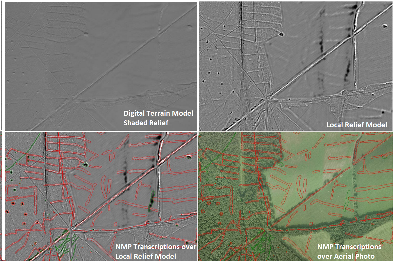
The Secrets of the High Woods was a 3-year HLF funded project to investigate the historic landscape hidden beneath the wooded downs of West Sussex using airborne laser scanning (commonly known as lidar). In March 2014, a bespoke survey was flown across 305km sq of the South Downs National Park allowing the creation of a 0.25m resolution digital terrain model and a number of specialist visualisations designed to highlight the micro-topography were derived from it.
In order to enhance our understanding of the historic environment using the new survey, we needed software that could match our key requirements which were:
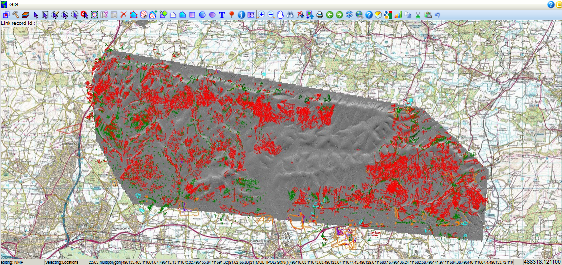
- Collation of the existing database and geospatial records from the three county Historic Environment Records that cover the project area (Hampshire, West Sussex and Chichester District), along with data from the National Monuments Record and partner organisations such as the National Trust and West Sussex Wildlife Trust.
- Integrated handling of the lidar-derived digital terrain and surface models, alongside the visualisations
- Multi-user interface to allow project staff and volunteers, partner organisations and contractors to work on the same datasets
- Ability to transcribe features from archive aerial photographs and lidar-derived visualisations to Historic England National Mapping Programme Standards
- Ability to collect ground observation in the field to enhance the desk-based transcriptions.
Over the course of 2014 the project team piloted small additions to the existing capability of the HEROS asset management system to tailor the software to fit this rather tall order! Specifically with the support of Historic England’s Aerial Survey Team and our contractors Cornwall County Council, we embarked on a pilot project to use the HEROS software to allow three teams in three locations to transcribe, record and analyse the lidar and HER data in a 12 month National Mapping Programme Project.
One of the key tweaks was the streamlining of the Digital Terrain Investigator to allow transcribers to interrogate the 3D data as they worked. With regard to the use of lidar-derived models for archaeological transcription at landscape scale, it has not before been possible to interactively view the 3D models in the same software as the digitisation and feature data recording. Feedback from the transcription teams regarding this element has been really positive enabling them to gain a better understanding of the terrain data.
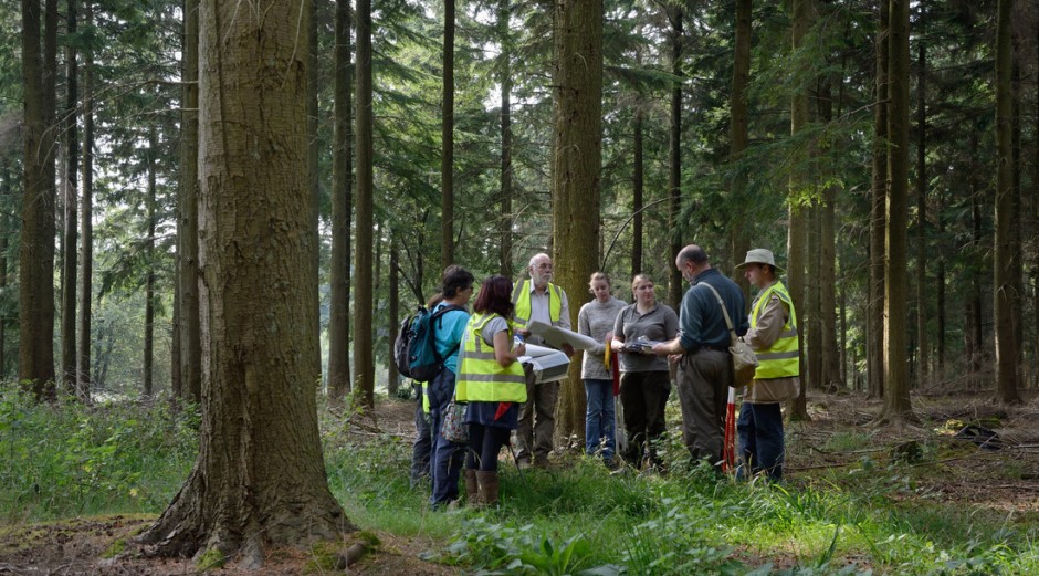
Importantly, the ability to work “apart-but-together” on the HEROS system has proved hugely advantageous for the project team and transcription teams, facilitating communication and sharing of records. As a HLF project, the Secrets of the High Woods has a really strong community engagement programme and HEROS software and field recorder app has allowed us use the NMP transcriptions with our volunteer field survey teams, overlaying them on the lidar-derived visualisations and other resources such as historic maps and creating field records that are automatically synced back to the central system.
The project was completed in March 2017. If you’d like to find our more about the results please visit our website.